Detailed maps & weather - updated frequently
This page is updated regularly. Check back here for the most up to date location, maps and weather info.
Current location: Near Mooloolaba, Australia.
View Larger Map
Current Weather Information
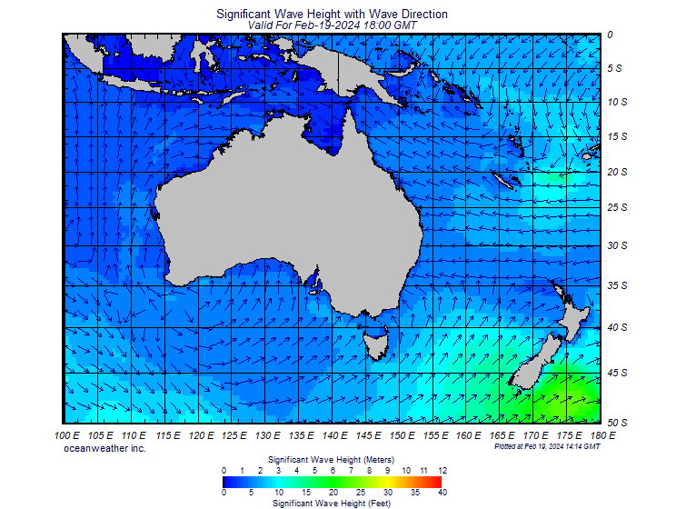
Arrows in above map indicate wave direction. Colours indicate wave height.
FAQ for these weather maps
How do I read a wind barb?
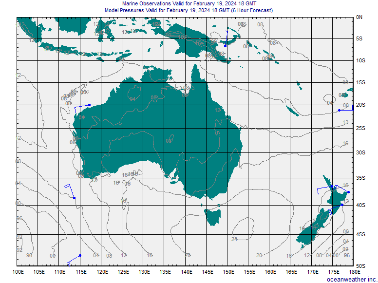
The wind barbs indicate both the wind speed in knots (nautical mile per hour) and the wind direction (from which the wind is coming from). Each flag on a wind barb indicates 50 knots, each long segment is 10 knots, and each short segment is 5 knots. To get the wind speed, just add up the flags and segments.
What are the different color wind barbs on the marine observations page?
Observations are color coded by type. Buoys are shown in red, ships are shown in blue and CMAN (Coastal Manned Stations around the U.S.) are shown in purple.
Where do the ship observations come from?
Ships that are part of the VOS (Voluntary Observing Ship) program report weather in realtime and this information is forwarded to weather centers around the globe. The NOAA VOS page www.vos.noaa.gov gives more information.
What are the gray contours on the marine observation images?
They are sea level pressure in millibars (mb). The labels are "short hand" that show just the last two digits: 998mb becomes "98", 999 mb is "99" 1000mb is "00" and 1001 mb is "01" and so on.
More Weather Links
South Pacific graphical weather - current conditions (from stormsurf.com)
South Pacific marine weather forecast from the World Meteorological Organization.
Current time for Geoff and Pete |
posted by stickybeak @ 9:11 AM
![]()

<< Home